The mini-keying workshop before the January 4, 2024 general membership meeting will focus on keying manzanitas and will be led by Bill Waycott and Dena Grossenbacher from 6 to 7 pm. Learn the key characteristics to identify manzanita species and practice on manzanita samples collected from the local area. Bring Vascular Plants of San Luis Obispo County, the Field Guide to Manzanitas, a 10x hand lens, a narrow-pointed dissection tool, and a headlamp. Some loaner equipment will be available at workshop. Please arrive a few minutes early so the workshop can start promptly. The room will open at 530 pm. NEW: slides from the workshop are now posted here: https://www.dropbox.com/sh/iehxgy6qs8z1idg/AAAdo3z6AiXlMsRjESdWZnria?dl=0
There’s still a lot to learn about our local manzanitas. At our January 4, 2024 general membership meeting, our speaker will be Bill Waycott on Manzanitas (Arctostaphylos) – Gifts that Keep on Giving. In addition, before the meeting, we will have a mini-keying workshop on manzanitas from 6 to 7 pm.
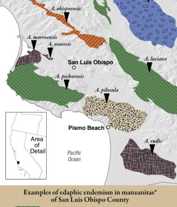
The California Floristic Province (CFP) is the center of diversification for the genus Arctostaphylos. Out 107 taxa, only a single subspecies in Guatemala has a restricted distribution outside of the CFP. Most manzanitas occur in specialized micro-habitats presenting adaptations to nutrient-poor soil types, diverse micro-climates, and differing elevations. The great majority of local endemics occur along the California coast, typically within or adjacent to the summer marine fog zone. In several coastal areas, clusters of species and local endemics are found in uplands around urban areas, such as San Francisco Bay, Monterey Bay, and in San Luis Obispo County, especially the Morro Bay and Guadalupe areas. We will discuss manzanita diversity, adaptation, their intriguing genetic components, and why we should all visit them in the wild.
Bill and his wife Diana are owners/operators of Nipomo Native Seeds, where they produce vegetable seeds along with CA native seeds. Bill has a PhD in plant genetics from UC Santa Cruz and has worked most of his career in agriculture. Bill’s involvement in CNPS dates back to his college days, and over the years he has served at SLO Chapter president, and vice-president on the State Board.
The mini-keying workshop before the general meeting will focus on keying manzanitas and will be led by Bill Waycott and Dena Grossenbacher from 6 to 7 pm. Learn the key characteristics to identify manzanita species and practice on manzanita samples collected from the local area. Bring Vascular Plants of San Luis Obispo County, the Field Guide to Manzanitas, a 10x hand lens, a narrow-pointed dissection tool, and a headlamp. Some loaner equipment will be available at workshop. Please arrive a few minutes early so the workshop can start promptly. The room will open at 530 pm.
Manzanita range map from Field Guide to Manzanitas: California, North America, and Mexico by Michael Kauffmann, Tom Parker, and Michael Vasey.
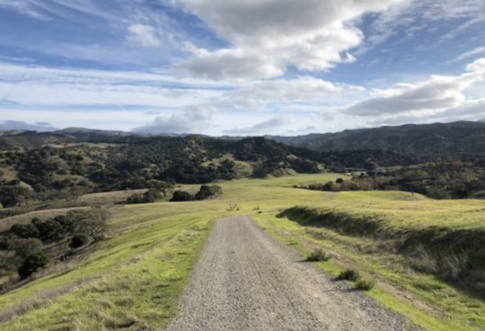
Join us to study the manzanitas that are adapted to the interior areas of San Luis Obispo County: big berry manzanita (Arctostaphylos glauca) and Eastwood‘s manzanita (A. glandulosa). Meet at the River Road (Blinn Ranch) entrance to Santa Margarita Lake County Park (35.315849, -120.417921). Total hike distance is 4 miles with an elevation gain of 500 ft.
From San Luis Obispo, the trailhead is a 40-minute drive. For those wanting to carpool, meet at 9:25 am at the Park & Ride area, just east of the Santa Margarita Exit off of Hwy 101 on Hwy 58 (35.383409, -120.626885).
Bring water, snacks, hat, sturdy shoes, and dress in layers for changing weather.A plant list for the Santa Margarita Lake area can be found on our website here. Rain or threat of rain cancels or postpones this trip.
This eighth manzanita hike with our chapter will look at two manzanita subspecies in detail in the maritime chaparral of Los Osos. If you have ever wondered how lines are drawn in plant taxonomy, especially between two subspecies, join us for this review of two subspecies of Arctostaphylos crustacea that occur within a one-mile
radius of each other:
a) subspecies crustacea (brittle leaf manzanita) and
b) subspecies rosei (Rose’s manzanita).
For this detailed investigation, bring a hand lens, note pad, and pencil, as well as the usual water, snacks, hat, sturdy shoes, and dress in layers for changing weather.A plant list for nearby Montaña de Oro State Park can be found on our website here. There are no bathroom facilities along the hike route. Rain or threat of rain cancels or postpones this trip.
This hike is 2 miles in length, with 200 feet elevation gain. Meet at the intersection of Bayview Heights Dr. and Bay Vista Lane in Los Osos (35.305432, -120.831412). Parking is available on Bay Vista Lane.
Manzanita Field Trip #7, West Cuesta Ridge, San Luis Obispo, CA. Meet at the start of the paved road (TV Tower Road) off Hwy US 101 at the top of Cuesta Grade, heading west. (35.347018, -120.630359). This outing is a combination car and hike field trip. At the start, we will consolidate into fewer cars, then proceed toward the Botanical Special Interest Area with stops along the way. At the Special Interest parking area, for those who wish to continue on foot, there will be a hike from that area. We will see one manzanita species on this outing, the local endemic Bishop manzanita (Arctostaphylos obispoensis, CNPS ranked 4.3), and walk through the unique ridge-top vegetation adapted to serpentinite derived soils: the Sargent Cypress and Coulter pine forest, leather oak (Quercus durata), and other chaparral species, etc., as well as the rare San Luis Obispo sedge (Carex obispoensis, 1B.2). Bring water, snacks, hat, sturdy shoes, and dress in layers for the weather. Note that the hiking route is rocky in some places and sturdy shoes and hiking poles are recommended. For more information about this manzanita species, see info here. A plant list for West Cuesta Grade can be found on our website here.
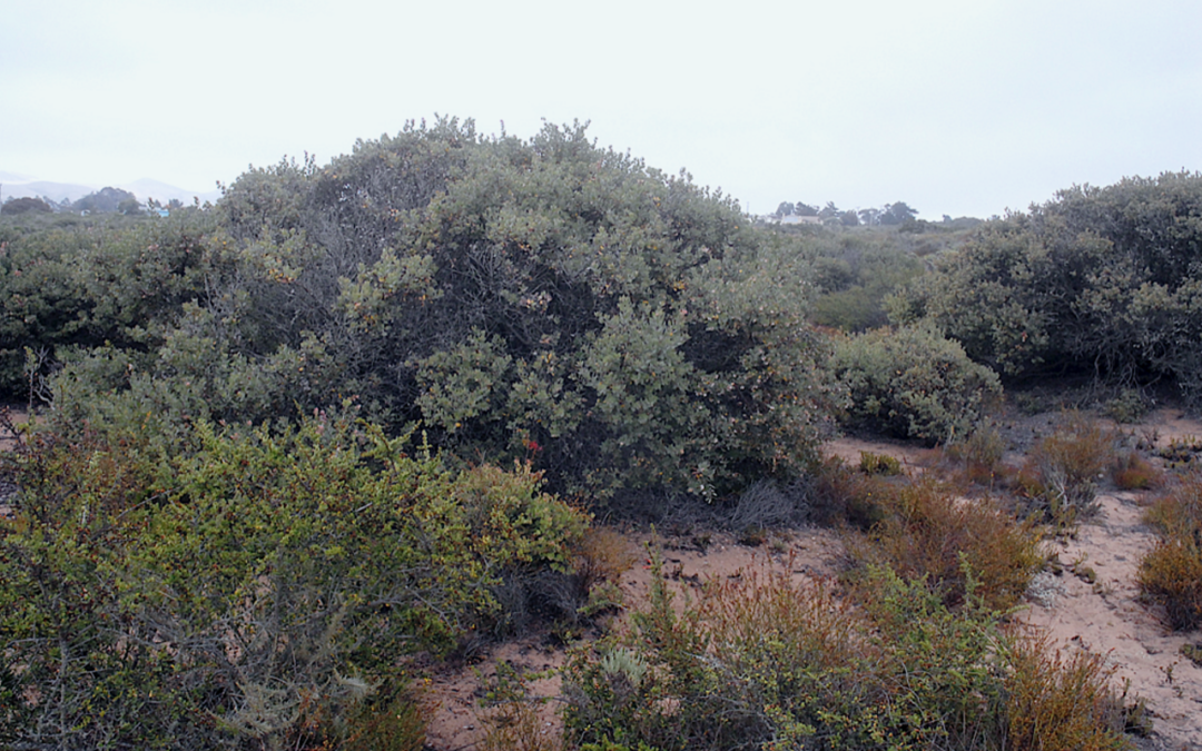
Join us at the corner of Highland Drive and Broderson Avenue in Los Osos (35.308747, -120.843166) for a walk through the unique maritime chaparral community where the local endemic Morro manzanita (Arctostaphylos morroensis) is one of the dominant species. This is a rare plant (CNPS ranked 1B.1), that grows within a radius of Los Osos of roughly 3 miles. Unfortunately, 70% of its habitat has been eliminated through land development and Eucalyptus plantings. We will see other rare plants on this walk, as well as discuss the management requirements for maintaining a resilient habitat and brittle leaf manzanita (A. crustacea). Bring water, snacks, hat, sturdy shoes, and dress in layers for the weather. Expect to walk 3 miles with 300 feet of elevation gain and in sandy soils. Rain or threat of rain cancels. For more information about this manzanita species, go to: https://www.calflora.org/app/taxon?crn=584 . A good plant list for this general area is for the nearby Montana de Oro State Park
https://cnpsslo.org/wp-content/uploads/2019/07/MontanŽa-de-Oro-Checklist-07Jun19.pdf
This fifth field trip in our manzanita series will occur in Monterey County at Fort Ord National Monument in partnership with the Monterey Bay CNPS Chapter. Called “Manzanita Heaven” by the locals, this park has many rare and endemic plants and five species or subspecies of manzanita including:
The field trip will start at the corner of Gigling Road and 8th Avenue in the City of Seaside where there is a dirt parking lot at the edge of Ft. Ord National Monument (36.643677, -121.787211, map below). Later, we will travel to a second location in the Monument to see Arctostaphylospajaroensis, Pajaro manzanita. These combined hikes are roughly 2.5 miles in length with a gentle terrain.
During the hike, we will test our skills keying manzanitas. If you don’t have a copy of the Field Guide to the Manzanitas by Kauffmann, Parker, and Vasey, copies will be available for sale on this hike.
Carpools from San Luis Obispo County will meet at 7:45 am in Templeton at the Las Tablas Park & Ride Lot, just west of Highway 101 at the intersection of Las Tablas Road and Bennett Way (35.553973, -120.713753).
Bring water, snacks, hat, sturdy shoes, and dress in layers for changing weather.Rain or threat of rain cancels or postpones this trip. There are no bathroom facilities along the hike route.
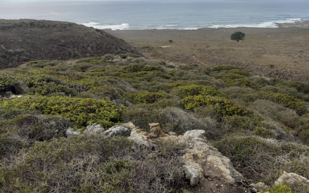
NOTE CHANGE IN LOCATION of this hike to Montaña de Oro State Park. We will hike the Rattlesnake Trail to observe the local endemic Pecho manzanita (Arctostaphylos pechoensis) then complete a loop on the Coon Creek Trail to see the unique riparian woodland as well as the brittle leaf manzanita (A. crustacea). This hike is 3.5 miles with a 600-feet elevation gain and should last 3 hours.
Park at the Coon Creek parking area which is at the farthest south dead end of Pecho Valley Rd in Montaña de Oro State Park (35.258068, -120.886966). Bring hat, sturdy shoes, water, snacks, and dress in layers for changing weather.
Plant lists for Montaña De Oro State Park can be found at the Finding Plants in the Wild page of our website.
Rain or threat of rain cancels. Because of access changes at PG&E Pecho Ranch, we needed to move the hike location to this nearby area in Montaña de Oro State Park.
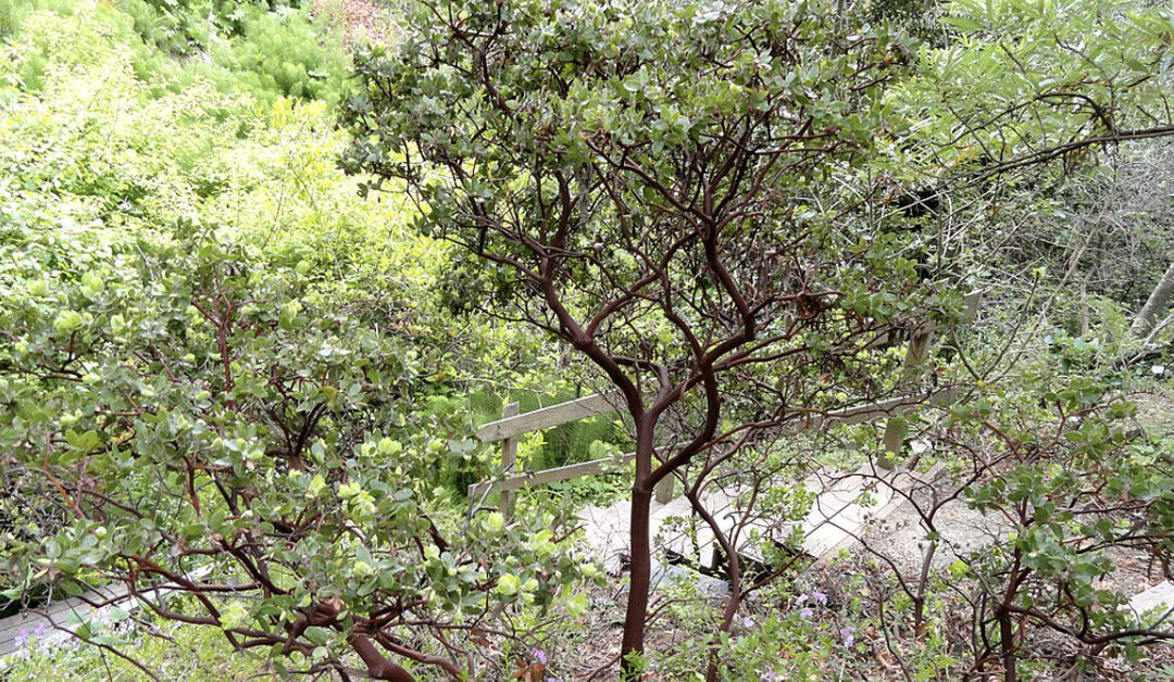
This hike will walk from the Nipomo Native Garden to the undeveloped north side of Nipomo Regional Park to view the rare sand mesa manzanita (Arctostaphylos rudis) as well as other Nipomo Mesa endemics. Some of these ancient relics may be the largest manzanitas in the county. Sand mesa manzanitas are one of nine locally endemic manzanitas, occurring only on the Central California coast.
Meet at the parking lot for Nipomo Native Garden located near the corner of Osage St. and Camino Caballo in Nipomo (35.036733, -120.503224). From there we will walk through the garden to the regional park. The hike is a total of 2 miles in sandy soil, with a 150 ft. elevation gain. Bring water, snacks, hat, sturdy shoes, and dress in layers for the weather.
A carpool option from San Luis Obispo will be available from Santa Rosa Park located at the intersection of Oak St. and Santa Rosa St. (35.289530, -120.665144) https://goo.gl/maps/gM1BY68Gr7qGPknV9, and departing at 9:00 am.
Information sheets and photos of some of the plants at the Nipomo Native Garden can be found here.
Rain or threat of rain cancels.
NOTE: This Nipomo Mesa hike is a replacement manzanita hike due to the weather-related closure of Los Padres National Forest which is preventing us from going to the original location of West Cuesta Ridge on January 22. The manzanita hike to West Cuesta Ridge will be rescheduled at a later date.
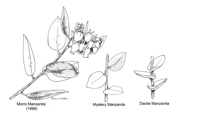
All three of Bonnie’s drawings this time are of manzanitas. One is a repeat of the endemic rare plant commonly known as Morro manzanita or Arctostaphylos morroensis. As you will see, it is included here to serve as a basis of comparison.
The other two drawings are new. One is of a single manzanita plant (maybe a clone) that grows near the mouth of Turri Creek where the Elfin Forest group’s 3rd Saturday Natural History Hike goes when it visits the salt marsh. It is currently in flower. The last is of a species commonly called, dacite manzanita (A. tomentosa ssp. daciticola). It grows nearby in the hills above the mouth of Turri Creek.
There are two other manzanita species that could also complicate the identification of our mystery manzanita. The first and most problematic is Oso manzanita (A. osoensis). Its recorded range is further away from our mystery, but still in the Turri Creek drainage. It is recorded as occurring on higher ridges and plateaus west of Hollister Peak on sandstone or dacite outcrops.
The last possibility is the Arroyo de la Cruz manzanita (A. cruzensis). It is this species that our plant would be if we used Robert F. Hoover’s 1970 edition of The Vascular Plants of San Luis Obispo County, California, for identification because it is the only species (other than A. morroensis) recorded for the area. Dacite manzanita and Oso manzanita were not recognized by Dr. Hoover as valid names.
So which name should we apply to our unknown manzanita? All who have attended these hikes readily concluded that the new manzanita is NOT the Morro manzanita. So if it is not Morro manzanita, what manzanita is it? This question, it turns out, is not easy to answer. This is where the third manzanita drawing comes in. It represents the dacite manzanita (Arctostaphylos tomentosa ssp. daciticola) which is one of two species found growing on the dacite, a granite-like rock which is dominant rock making up the Morro Sister Peaks. Outcrops of this rock weather into thin, infertile soils.
Dacite manzanita is found only within the Turri Creek drainage. I assume most will agree that, if our unknown is not Morro manzanita, it shows a much closer, but not perfect match to the dacite manzanita.
The identification of manzanitas is not easy. First, there are many species (60+ and many subspecies and varieties) recognized as growing in California. Second, I suspect all who have even a passing familiarity with California native plants can identify a manzanita. This means the genus has an easily recognized set of characteristics. It also follows that telling its many species apart is going to be a challenge because species characters must be of necessity minutely different or technical in nature.
However, they can be divided into groups based on the length of their leaf stalks (petioles) and the shape of the leaf blade base. One group, which includes the Morro manzanita, has an easily seen but short (< 4 mm) leaf stalk (petiole) and a smooth, rounded to chordate blade base. A chordate leaf base is going to resemble the top of a valentine heart. The other group has petioles either absent or so short (< 2 mm) that they would not easily be seen unless one looks carefully. Their leaf bases also resemble the top of a valentine heart (chordate). Neither of these traits is present in Bonnie’s Morro manzanita drawing which was probably based on a plant from Montana de Oro State Park. But they are found in the other two drawings.
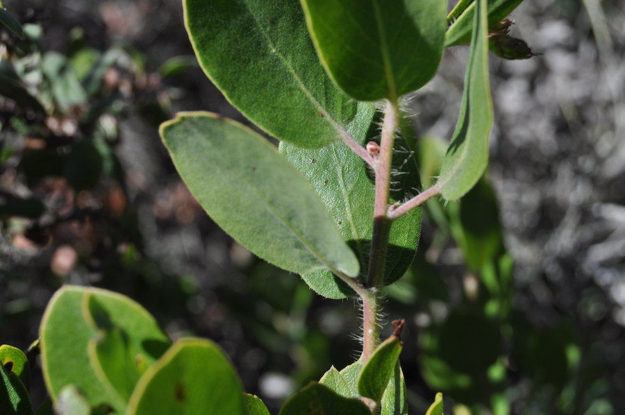
There are other technical attributes of course, but most of these are not visible without a microscope or hand lens. One character that does not require a microscope, but does require some “digging” is whether or not a manzanita produces a large swelling at the junction where the root turns into the base of the stem. In those that don’t produce the swelling, which includes the Morro manzanita, branching doesn’t usually begin until the main stem (trunk) is a few inches or more, sometimes up to a foot or more, above the ground surface. These are called tree manzanitas due to that single trunk.
Those that branch from the swelling below ground are commonly called shrub manzanitas. Manzanitas that produce this structure tend to form their first branches below ground which produces a bunch of stems in a tight cluster. Again this trait should eliminate the Morro manzanita from consideration because it usually begins to branch at or above the soil surface.
So if it is not Morro manzanita, which of the other manzanitas is it? The Arroyo del la Cruz manzanita, as currently defined, should range from Cambia northward. The Los Oso manzanita is reported to be a relatively tall shrub (3 to 12 feet) and is reported to be restricted to dacite or sandstone outcrops. The dacite manzanita occurs just up slope from our mystery manzanita but is also supposed to be restricted to dacite outcrops. Our mystery manzanita grows on a relatively narrow terrace well above the salt marsh and just below the foundation fill used to raise South Bay Boulevard above the Morro Bay estuary. It is growing in coarse sandy soil probably derived from the fill. It is growing with species characteristic of coastal scrub with a large compliment of weeds. That is, it is growing in a classic, disturbed, man-made habitat. Such habitats are known to allow unusual individuals such as hybrids to occur out of typical range or habitat and become established. In other words, range and habitat can’t be used to limit the possible ID.
So what is its correct identification? I’m still quite unsure. Even the Cal Poly Herbarium is not much help here. I think I could find all three possible species among the specimens within each single species folder in the Cal Poly Herbarium. I do have to admit that the differences among the three short petiolate, chordate leaf-based species depends on the often subtle nature of the kind of hairs (pubescence or trichomes) found on twig and leaf. As stated earlier, these traits require at least a hand lens to observe. I think it is safest to leave it as a mystery manzanita. Maybe, a Cal Poly Senior Project or Masters student will take on this project and find the correct answer for us.
It appears that all the species from the Turri Creek drainage are closely related, at least based on appearance. With additional modern taxonomic techniques maybe it may even be determined that Dr. Hoover was correct back in 1970 when he concluded that all (except Morro manzanita) are the same species.
P.S. After writing the preceding paragraphs, I went back out and observed the three pictured manzanitas again. This time I walked through the Elfin Forest to reacquaint myself with the variability found among Morro manzanita individuals. The plants along the Board Walk are similar to Bonnie’s drawing. But if you observe the manzanitas along the Habitat Trail that goes off the north-east curve and goes toward South Bay Boulevard, you will find that the Morro manzanitas get shorter and shrubbier and their leaves have shorter petioles and more deeply lobed leaf bases. It’s a mini-cline. In other words they begin to resemble more and more our mystery manzanita. So, I’m forced to conclude, at least tentatively, that our unknown manzanita is simply an extreme form of Morro manzanita. If so, it may be the most northern individual of the species. I conclude this in spite of all of us assuring ourselves that is was clearly different from the Morro manzanita we all had pictured in our minds. I still think there is a good student project here, however.
by Dirk Walters, illustrations by Bonnie Walters | Dirk and Bonnie Walters are long-time CNPS-SLO members, contributors, and board/committee participants. In addition to his work at Cal Poly, Dirk is the current CNPS-SLO Historian.